 FAO Map Catalog
FAO-UN - ex-FAO Agrometeorology Group of Sustainable Development Department
Type of resources
Available actions
Topics
Keywords
Contact for the resource
Provided by
Years
Representation types
Update frequencies
status
Scale
-
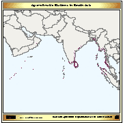
The layer provides the agro-climatic stations located on the Asian coastal areas affected by the Tsunami.
-

Average altitude in Djibouti, Eritrea, Ethiopia, Kenya, Somalia, Sudan and Uganda.
-
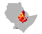
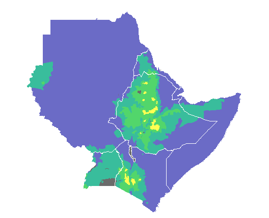
Teff yield in Djibouti, Eritrea, Ethiopia, Kenya, Somalia, Sudan and Uganda. Map presents reference yield estimated through data collection and agricultural statistics.
-
Average terrain-slope characteristics in Djibouti, Eritrea, Ethiopia, Kenya, Somalia, Sudan and Uganda.
-
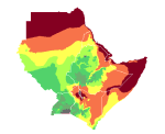
Length of growing period in Djibouti, Eritrea, Ethiopia, Kenya, Somalia, Sudan and Uganda.
-
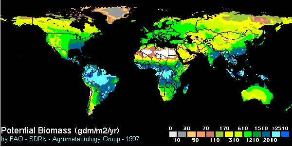
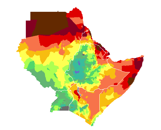
Potential biomass is the amount of plant biomass that can be accumulated in one year under the assumption of ideal conditions prevailing for photosynthesis, i.e. absorption of solar energy by plants and storage of the energy as plant material. This map uses one of the earliest methods, developed by H. Lieth and published in 1972. Although this approach is now largely superseded by more complex approaches involving solar energy conversion efficiencies, Lieth's method is interesting in that it clearly shows whether temperature - cold or warm - or water is the main limiting factor. (The unit of measurement is grams of dry matter per sq. metre per year.)
-
Annual mean temperature in Djibouti, Eritrea, Ethiopia, Kenya, Somalia, Sudan and Uganda.
-
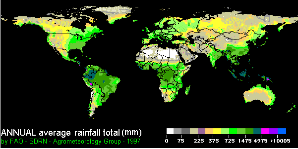
This map is part of a series of global climate images produced by the Agrometeorology Group and based on data for mean monthly values of temperature, precipitation and cloudiness prepared in 1991 by R. Leemans and W. Cramer and published by the International Institute for Applied Systems Analysis (IIASA). For each of the weather stations used data have been assembled over a long time period - usually between 1961 and 1990 - and then averaged. Annual totals for rainfall were derived from the monthly values.
-
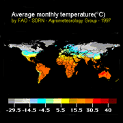
This map is part of a series of global climate images produced by the Agrometeorology Group and based on data for mean monthly values of temperature, precipitation and cloudiness prepared in 1991 by R. Leemans and W. Cramer and published by the International Institute for Applied Systems Analysis (IIASA). For each of the weather stations used data have been assembled over a long time period - usually between 1961 and 1990 - and then averaged.
-
Average annual rainfall in Djibouti, Eritrea, Ethiopia, Kenya, Somalia, Sudan and Uganda.